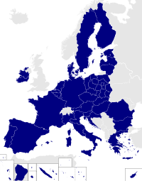
Tag:political_division=euro_const
Jump to navigation
Jump to search
| Description |
|---|
| A boundary needed to represent European Parliament constituencies |
| Group: boundaries |
| Used on these elements |
| Requires |
| Useful combination |
| Status: in use |
| Tools for this tag |
|
A boundary way or relation that is solely needed to represent European Parliament constituencies in OpenStreetMap, and not for other administrative or political divisions.
For tagging the European Parliament constituency itself, see euro_const=*.
